
We publish thousands of unemployment rates each month for states, metro areas, and counties. That can make them hard to follow, but we just upgraded our mapping tool to make it easy. Instead of wading through all those numbers, just check out the latest maps for what you need. We have rebuilt the tool using a more modern and versatile mapping technology. That will make it easier to update with future geographic changes. We have improved several features of the tool:
- We have added tooltips to help you identify each area and its data. Just hover over an area on the map to see its information.
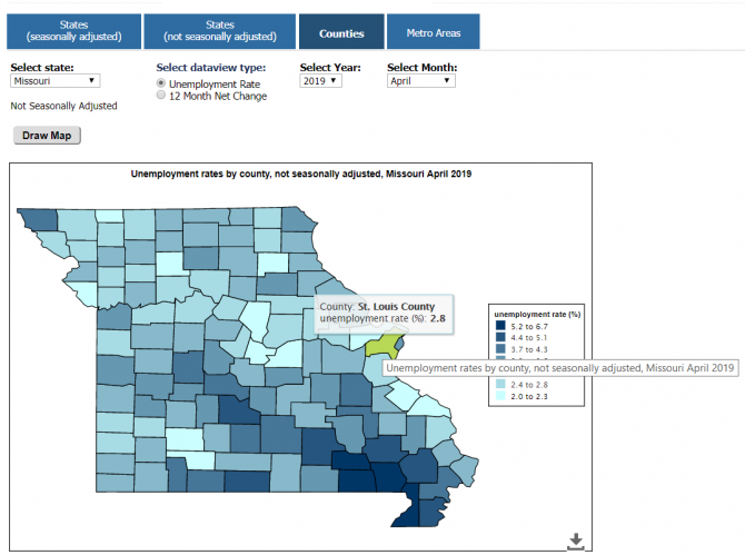
- In the tab for state data that are not seasonally adjusted, you can choose a state and pull up a map of that state’s county data for the same period.
- The metro area tab has returned and reflects the areas currently used by the Local Area Unemployment Statistics program.
- You can choose the dates, states, areas, and measures you want to see.
- You can select the key data ranges to highlight all areas in the same group. (Click or press the range a second time to deselect.)
- The map space is larger and framed.
- Use the arrow in the lower right corner of the map space to print the map image or export it to .PNG, .JPEG, and .SVG formats.
We hope these improved maps make finding data for your state and local area easier. Let us know what you think.